
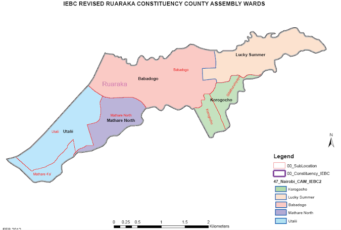
Utalii, a ward in Nairobi County, operates under the postal code 00600. Administratively classified as a ward, it falls within the Ruaraka Constituency and Ruaraka Sub-County, forming part of Nairobi’s northeastern urban zone. Geographically, Utalii lies adjacent to key areas like Baba Dogo and Mathare North, situated near major highways connecting Nairobi’s central business district to Thika and surrounding regions.
Utalii at a Glance
| Information | Details |
|---|---|
| Administrative Type | Ward |
| Parent County | Nairobi |
| Parent Sub-County | Ruaraka Sub-County |
| Parent Constituency | Ruaraka Constituency |
| Geographic Location | Northeastern Nairobi |
| Total Area (sq km) | – |
| Population (latest census) | – |
| Number of Subdivisions | – |
| Administrative Headquarters | Ruaraka Sub-County Offices |
Administrative Structure
Utalii’s governance is structured under Nairobi City County’s devolved system, with a Member of County Assembly (MCA) representing the ward in legislative and development matters. The ward reports to the Ruaraka Sub-County Administrator, who oversees service delivery and coordinates with county departments like health, education, and infrastructure. Key administrative offices include the Ruaraka Sub-County headquarters, which houses critical services such as land registration and public health coordination.
Complete Utalii Postal Codes
Utalii’s postal code 00600 corresponds to the Ngara Road post office, which services the broader area. This code follows Kenya’s five-digit system:
- 0: Nairobi region
- 06: Central Nairobi district
- 00: Delivery zone for Utalii and adjacent areas.
| Area/Location Name | Postal Code | Facility Type | Operating Hours |
|---|---|---|---|
| Utalii Ward | 00600 | Postal Delivery Zone | – |
| Ngara Road Post Office | 00600 | Post Office | Mon–Fri: 8 AM–5 PM |